




Here's How State DOTs are Using Drones
The use of drones among state Departments of Transportation has grown significantly, from 45% of state DOTs in 2018 to 72% in 2019, according to a recent survey.

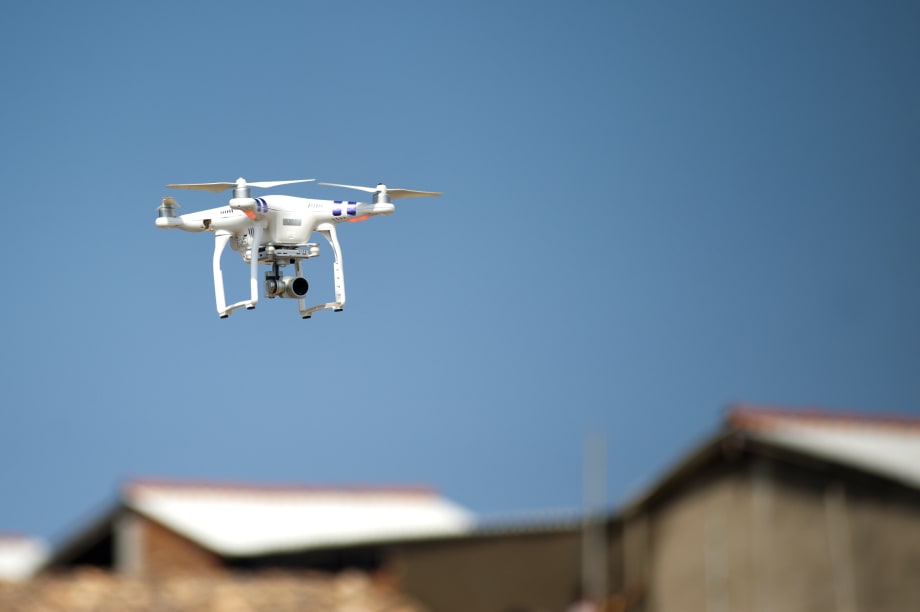
Photo via Pexels
The use of drones, also known as unmanned aerial systems (UAS), among state Departments of Transportation has grown significantly, from 45% of state DOTs in 2018 to 72% in 2019, according to a May 2019 survey by the American Association of State Highway and Transportation Officials (AASHTO).
These DOTs have hired hundreds of staff to manage drone operations, including 279 Federal Aviation Administration (FAA)-certified drone pilots on staff — or approximately eight pilots per state.
“The survey is just one example of how state DOTs are investing in the next-generation workforce,” said Carlos Braceras, executive director of the Utah DOT and AASHTO’s 2018-2019 president. “Five years ago, you’d be hard pressed to find any state DOT looking to hire a drone pilot or set up a UAS program — but now we’re doing both of those things in a big way.”
The types of missions and research being conducted by state DOTs varies widely. AASHTO’s survey finds that the top five drone missions in order of frequency are: 1) photo and video gathering mainly of infrastructure projects; 2) surveying; 3) inspecting infrastructure including bridges, signage, light poles, and pavement; 4) responding to emergencies and natural disasters; and 5) for public education and outreach. In total, state DOTs identified more than 20 mission types including the observation and management of endangered species, underwater vegetation, and traffic monitoring.
The Ohio DOT, through DriveOhio’s UAS Center and in partnership with the Air Force Research Laboratory as well as other partners, are developing SkyVision, a ground-based detect-and-avoid system that is being used to track drones to enable beyond-line-of-sight operations.
“Imagine highways in the sky,” explained Fred Judson, acting director of the Ohio UAS Center. “Invisible lanes of travel for low-altitude drones and other small unmanned aircraft. Package deliveries will be just one of the many missions drones will be flying in that airspace. Just as the FAA tracks jetliners on the ground and in the air, SkyVision will do the same thing for drones.”
When AASHTO conducted its first UAS/drone survey in March 2016, no state DOT had incorporated drones into their daily operations. At that time, 33 state DOTs were exploring, researching, or testing drones, as well as developing internal policies to manage them.
“In three short years, we’ve gone from zero to 36 state DOTs executing drone missions internally,” said Jim Tymon, AASHTO executive director. “This giant leap is helping states work safer, smarter, and faster than ever before and that adds up to big savings for taxpayers and improved safety for motorists.”
Improving Safety With Access to More Data
The survey found that drones are being used to mitigate avalanches in high-elevation states. In January, when Utah DOT set off one of its Gazex avalanche exploders along the Wasatch Front, a deluge of snow covered SR 192 in 30 feet of snow. No one was hurt, but it took the agency’s crews 24 hours to clear the highway.
“The key to avalanche mitigation is data,” said Paul Wheeler, the UAS program manager at Utah DOT. “This summer for the first time, we’ll begin mapping avalanche ‘hot spots’ with drones equipped with Lidar sensors to create detailed three dimensional maps of the landscape. When the snow falls, we can use those maps to measure the depth of the snow to better mitigate avalanches. Making the right call at the right time keeps everyone safe and the roadways clear.”
Reduced Manpower, Equipment Use Results in Cost Savings
The survey also found that 29 states said drones are helping them save money. How much? The Michigan DOT calculates that a manual inspection of the deck on a four-lane divided highway bridge located near a metropolitan area would take a two-person crew using heavy equipment eight hours to complete — at a cost of $4,600. But the agency said conducting the same inspection using drones would take one pilot and one spotter one hour to complete at a cost of $1,200 — a 74% savings. In addition, Michigan DOT estimates there would be an additional $14,600 in user delay costs from lane closures. No lane closures are necessary using drones.
Using Drones for Research and Economic Development
AASHTO’s survey also found 24 state DOTs are conducting research with an academic institution. Three state DOTs are gathering real-world data through their participation in the FAA’s Integration Pilot Program (IPP) which allows them to fly drones beyond visual line of sight, at night, and over people — three things drone operators cannot do at this time without a special FAA waiver.
Under its IPP, Kansas DOT wants to help to create what are called “smart farms.” The agency is deploying drones to conduct “Precision Agriculture,” which includes monitoring soil temperature, humidity, plant growth, and irrigation levels. The Kansas DOT is also monitoring the heat signatures of cattle. By identifying sick animals faster, farmers and ranchers can protect other animals from getting sick. The agency is also deploying drones in rural areas to inspect power lines, railroad tracks, and highway pavement — items termed “linear infrastructure.”
“We take safety very seriously,” said Lindsey Dreiling, deputy director of aviation and UAS at the Kansas DOT. “We’ve flown more than 150 drone missions, covering more than 800 miles without issue. We’re demonstrating that even in densely populated rural areas, drones can assist farmers, ranchers, utilities, and infrastructure stakeholders make smarter and faster decisions.”
In addition to infrastructure inspections and crop health monitoring, the North Dakota DOT is deploying drones for emergency response as part of its IPP. In North Carolina, agency officials are gathering real-time data on the viability of commercial package delivery. Working with its private sector partners, the North Carolina DOT began in March executing hundreds of successful drone package deliveries using predetermined docking stations within a defined airspace.
“Conventional highways have for 60 years been the backbone of economic development in America,” said Basil Yap, manager of the North Carolina DOT’s UAS program. “Now, state DOTs are helping to plan and build highways in the sky. We know that commercial drone delivery is coming and our research is focused on helping small businesses develop this capability.”
The FAA’s IPP programs will end in the fall of 2020.
AASHTO’s May 2019 survey found that 36 state DOTs out of 50 have staff dedicated to drones: Alabama, Alaska, Arizona, Arkansas, California, Colorado, Delaware, Georgia, Idaho, Illinois, Iowa, Kansas, Kentucky, Louisiana, Maine, Massachusetts, Minnesota, Montana, Nebraska, Nevada, New Hampshire, New Jersey, New Mexico, North Carolina, North Dakota, Ohio, Oklahoma, Oregon, South Carolina, Tennessee, Utah, Vermont, Virginia, Washington State, West Virginia, Wisconsin.
More Operations

Is Keeping Older Fleet Vehicles Really Saving Money?
Is keeping vehicles longer saving money, and what happens when a diagnostic test points to the wrong fix?
Read More →
How Smart Fleet Strategy Can Help Local Government Agencies Do More with Less
Keeping a vehicle longer may ease this year’s budget, but what does it cost the next one? A closer look at fleet decisions can reveal opportunities to reduce spending while protecting essential services.
Read More →
Connect with Government Fleet on LinkedIn
From industry news and fleet management strategies to conversations with peers, Government Fleet's LinkedIn page offers public-sector fleet professionals another way to stay informed and connected.
Read More →
Town of Queen Creek Named Most Successful Fleet Award Winner of Inaugural RTA Fleet Success Awards
Five fleets were honored at RTA Connect 2026 in Chicago for excellence across resource efficiency, intentional culture, risk management, and stakeholder satisfaction.
Read More →
A buyer's guide to fleet management software in 2027
Buying fleet management software in 2027 means looking beyond features and price. As fleet operations, technology and expectations evolve, this guide explores what today’s fleet professionals should consider when choosing a system that can deliver value now and adapt to what comes next.
Read More →
Hazard Alerts, Fleet Car Sales Rise and a New Shuttle Concept
Fleet car sales doubled, but the bigger picture tells a different story in this week’s roundup.
Read More →
How St. Johns County Turned Fleet Data Into Better Replacement Decisions
St. Johns County, Florida, had fleet data, but turning it into reliable decision guidance was another matter. Instead of starting over with a new fleet management system, the county connected existing tools and built a scoring system that gives managers an objective look at fleet health.
Read More →
Fleet Forward Conference Introduces One-Day Passes for 2026
New one-day registration lets fleet professionals attend Tuesday, Wednesday, or Thursday, with passes available for $249.
Read More →
ENC Unveils its ZAVIR Medium-Duty Shuttle
Two variants of the concept shuttles were revealed: a low-floor configuration and a high-floor configuration.
Read More →
Could Your Next Fleet Technician Start as an Intern?
What if your next technician hasn’t worked in a fleet shop yet? What fleets are doing to free up time.
Read More →