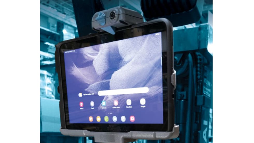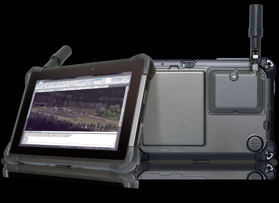
The DT301T Rugged RTK Tablet is purpose-built for GIS mapping applications with Real Time Kinematic (RTK) satellite navigation used to enhance the precision of position data derived from satellite-based positioning systems. The military-grade tablet carries an IP65 rating but remains lightweight, offering the versatility to be used in the field, office, and vehicles. It is compatible with existing GIS software for mapping applications and brings together the advanced workflow for GIS data capture, accurate positioning and data transmitting.
The tablet can be used in a variety of scenarios, including forensic mapping. Public safety teams, investigators, and crash reconstructionists can use the DT301T-RTK Tablet to accurately collect measurements that are scientifically defensible by using the real-time centimeter reference points to position 3D point clouds created from aerial photogrammetry or take stand-alone measurements.
Additional applications include land surveying, construction, and building information modeling.
Some key features of the tablet include:
Dual Frequency GNSS Module: GNSS L1 & L2 RTK that receives GPS, GLONASS and GALILEO signals up to 372 channels with RMS 10 mm + 1ppm accuracy.
High Performance CPU and Windows OS: Intel 6th Generation Core i5 or i7 processor with Microsoft Windows 7 Professional or Windows 10 IoT Enterprise. Units come with either 8 GB or 16 GB of RAM.
High Capacity Hot-Swappable Battery Pack: Delivers 60 or 90 watts for up to 15 hours of continuous mobile communications.
Accessories: The DT301T Rugged RTK Tablet is complemented by a variety of accessories, including: external antennas, pole mount cradles, detachable keyboards, battery charging kits, and digital pens.
The DT310T-RTK offers one terabyte of data storage, long-range Class 1 Bluetooth, and a 10.1-inch sunlight-readable screen with capacitive touch and a 1920x1200 resolution.