Use of unmanned aerial vehicles (UAVs), or drones, have become more common, and public agencies are using them to document traffic accidents and crime scenes as well as help with fires, hazmat calls, and urban search and rescue.
by Daryl Lubinsky
May 4, 2016
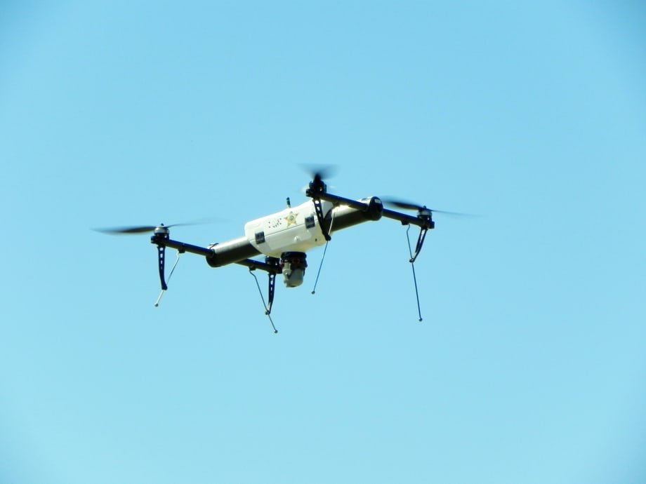
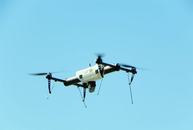
Northeast Region UAS Unit members of the Grand Forks County (N.D.) Sheriff’s Department operates this AeroVironment Qube. Photo courtesy of Alan Frazier
9 min to read
Ad Loading...
Northeast Region UAS Unit members of the Grand Forks County (N.D.) Sheriff’s Department operates this AeroVironment Qube. Photo courtesy of Alan Frazier
The small unmanned aviation systems unit for the Ventura County (Calif.) Sheriff’s Office recently used an unmanned aerial vehicle (UAV), or drone, to assist in the search and rescue of a missing hiker. Office personnel spent day and night during the four-day operation searching for the missing subject. In the daytime, the crew used a color camera from the aircraft to search trail heads and creeks. At night, the crew used an infrared heat detection camera on the UAV in an attempt to find a heat source from the missing man. Officials eventually found the hiker, who was deceased.
At a Glance
Government agencies are using unmanned aerial vehicles, or drones, for tasks such as:
Documentation of traffic accidents
Documentation of crime scenes
Searching for crime suspects and other missing persons.
“We didn’t actually locate him, but we just cleared a bunch of areas so we could tell positively he wasn’t in certain areas,” said Cmdr. Chris Dunn, who manages the Ventura unit. The unit applied with the Federal Aviation Administration (FAA) in late 2011 to use the UAV, which is a Qube quad-rotor model from AeroVironment. The unit flew the UAV in a test and evaluation phase from 2012 to 2013 and has been flying it jurisdiction-wide since January 2014.
Ad Loading...
Grand Forks, N.D. County Sheriff’s deputies on early morning patrol about 18 months ago saw a vehicle driving erratically and signaled for it to stop. The driver stopped, but all three suspects ran out of the vehicle and into a cornfield. The deputies called for an unmanned aircraft system (UAS) from the Northeast Region UAS Unit to assist in searching for the men. Deputies caught one suspect quickly, and another got away, but deputies caught the third suspect the next morning. Asked why he hid rather than ran, the captured third suspect said he could see the UAS and knew if he moved, the UAS would see him.
“The other suspect could see the aircraft, which projected a mild omnipresence where he felt, ‘If I move they’ll see me so I’ll stay right here.’ It contained him rather than having him flee and escape like the other suspect,” said Alan Frazier, associate professor with the University of North Dakota Department of Aviation and deputy sheriff at Grand Forks County. Frazier oversaw the creation of a regional law enforcement unmanned aircraft system (UAS) unit in the state that assists in emergency services such as law enforcement, fire, and search and rescue operations.
Public agencies are using unmanned aircraft systems to search for crime suspects and other missing persons, but those are less common ways that the aircraft are deployed. The most common uses are for further documentation of traffic accidents and crime scenes.
Fleet departments aren’t normally responsible for maintenance and repair of unmanned aircraft — instead, owners, pilots, or the manufacturer handle these duties. But their rising use can impact fleets. Changes include adding command center vehicles built to integrate with video from UAVs, and even a reduction in vehicle and helicopter use as certain tasks are replaced by unmanned aircraft.
Tactical Situations
“It definitely has its uses, especially during tactical situations and [when] we can get an eye in the sky and provide information to the incident commanders about how they’re going to respond to situations,” said Dunn, who has been with the sheriff’s office since 1994. “We’ve used it on a wildland river fire to help fire crews.” The department was waiting to receive its second UAV, another Qube quad rotor, which was scheduled to arrive in April.
Ad Loading...
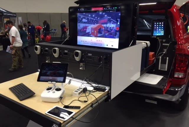
This command vehicle from the City of Anaheim (Calif.) Fire & Rescue Dept., has a 42-inch video monitor to show video footage from the UAS. Photo courtesy of Anaheim Fire & Rescue
Early Stages of Adoption
Some public agencies field full drone programs, but many are in various stages of getting Federal Aviation Administration (FAA) approval for their programs. According to a March 2016 survey by the American Association of State Highway and Transportation Officials, about 33 state departments of transportation are exploring, researching, or testing drones.
The City of Anaheim, Calif., Fire & Rescue Department is going through the approval process to fly its two UAS units legally on public safety calls, said Jeff Alario, deputy chief of support services for the department, which operates 11 fire stations with 10 fire engines and six truck companies.
Anaheim Fire & Rescue began looking into the use of UASs last year, and a city innovation team arranged for a UAS to be brought in for city officials to inspect. Some funding remained in its technology fund, so the department eventually purchased two small unmanned aircraft systems, the Inspire 1 and the Phantom 3 from flying and camera stabilization system company DJI. Cost for the Inspire was about $3,500, and the smaller Phantom went for about $1,100. “That’s not a huge amount of money for what we can do with it,” Alario said.
Frazier’s unit uses more expensive systems. One is an AeroVironment Qube quad copter with four rotors that sells for about $50,000. The Raven, which is an airplane-type platform with three aircraft and a ground control station, goes for about $170,000. Two other systems Frazier’s unit uses come from Draganfly Innovations out of Canada. Those systems sell for about $30,000 apiece.
The Anaheim department has used the less-expensive systems on non-public safety missions such as videotaping its fire training from angles that it could not reach in the past, as well as roof operations and ladder operations that it could not videotape before without hiring a helicopter service.
But immediately after receiving the units, the department began research with the FAA to make sure it could fly them legally. The department learned that three types of users can fly UASs: individuals, with certain restrictions; commercial users for projects such as infrastructure inspection, photography, and real estate surveys; and public safety personnel.
Dave Barry, EMS captain for Anaheim Fire & Rescue, who oversees its UAS program, noted that the department’s application process for FAA certification is about 80% complete.
“Once the process is complete, we’ll get our training seal that will allow us to do some training on different operations. I’m thinking mid-summertime, you might see us out on an actual incident,” Barry said. Those include fires, hazmat calls, and urban search and rescue calls.
For the future, Barry sees potential uses during a hazmat incident in which the drone could fly close to the affected area and gather more information. For search and rescue, if someone is trapped over the side of a cliff, the UAS could get closer to the area and help officials determine the best access to get to the trapped individual. The cost to use a UAS is considerably less than using a helicopter.
On wildland fires, Barry stressed the importance of making sure the UAS is not in the way of helicopters in the act of fighting the fire. But after the fire is out, the UAS could be used to look for hot spots with an infrared or heat-sensing camera.
Ad Loading...
The department could use the UASs in the future for larger-scale incidents such as earthquakes, tornados, and flooding.
“This gives people managing the incident the ability to get out and survey an area, see what roads are blocked off, maybe numbers of people, where they are and how we can get to them and help them, and get big surveys done quickly that we used to try to do manually by driving in a fire engine or 4-wheel-drive vehicle,” Alario said. “There are a lot of applications that we’re just now starting to get into.”
The UASs have video and photo capabilities, and two of the department’s fire trucks are command vehicles that include 42-inch video monitors. Battalion chiefs responsible for managing large-scale incidents drive those ¾-ton Dodge pickups.
“We have the ability to plug the drone feed right into that so they have the ability to see whatever the drone sees,” Alario said.
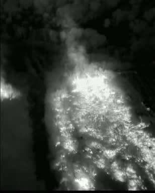
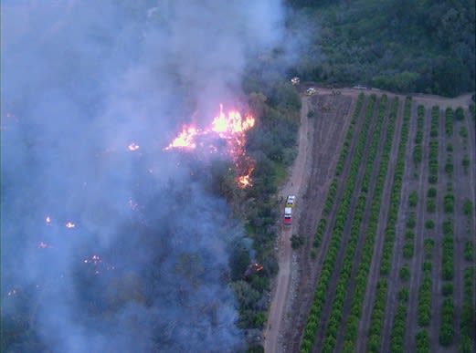
The Ventura County (Calif.) Sheriff’s Office’s UAV captured day and night images of fires. Photo courtesy of Ventura County Sheriff's Office.
Addressing Privacy
Privacy issues have been brought up regarding the use of drones, but Alario has not heard any concerns in his city. The UASs the city use fly low, with not much zoom capability, and the city’s proposed uses, for fires and hazmat incidents, don’t usually lead to privacy concerns. He added that if footage was used externally, all federal privacy regulations would apply.
Ad Loading...
Frazier of the University of North Dakota thinks along those same lines, believing that privacy concerns regarding UAVs have been blown out of proportion. Questions about privacy come to the surface anytime government uses a tool to observe the public, he said.
The U.S. Supreme Court ruled in what Frazier said were landmark cases in aerial surveillance — California v. Ciraolo and Florida v. Riley — that aerial observations from aircraft were legal as long as the aircraft is in a place where other aircraft can legally be.
“There was no expectation of privacy on the part of citizenry on the ground from aerial observation in those cases,” Frazier said. “Although the Supreme Court hasn’t had an unmanned aircraft case yet, I’m sure they will at some point in the future. Until that happens, it’s logical to apply those manned aircraft cases to unmanned aircraft.”
But he feels government agencies considering the use of unmanned aircraft should still address privacy concerns. Frazier’s regional law enforcement UAS unit holds a training session every year that covers privacy issues related to UASs. Some steps to ensure privacy include not aiming the UAS’s camera at anything that is not the subject of the investigation. The unit only retains images for a 10-day period, unless the images have evidentiary value. All other images are destroyed after that. If it has evidentiary value, the image is transferred to a memory stick and booked into evidence, where it is secure with a chain of custody so only authorized personnel have access to it. The unit also does not conduct proactive patrol. It only responds reactively.
“All of those things we think give pretty robust protection of privacy to those we protect,” Frazier said.
Ad Loading...
The Ventura County (Calif.) Sheriff’s Office’s UAV captured day and night images of fires. Photo courtesy of Ventura County Sheriff's Office.
Growing Use
If a government agency is interested in using UASs, Frazier recommends first gathering information through simple Web searches. He is active with the Airborne Law Enforcement Association, and he would recommend that interested agencies become familiar with that group.
Alario feels government agencies should look into the use of UASs for different aspects of public safety. For his department, it’s another instance of technology helping improve operations. The department now uses mobile data computers in its trucks, which helps firefighters get calls more quickly. Paperless paramedic reporting has helped streamline the reporting process, and the department can run training videos on iPads.
“There really wasn’t much technology in the fire service before,” he said. “So this was just another piece of technology that’s out there, and [Barry] and I sat down and said, this might just help us do our job better and provide a better service to our citizens in Anaheim.”
Dunn of the Ventura County Sheriff’s Office said he is waiting for software technology to advance so his department can conduct traffic accident scene processing and crime scene processing. “We see that as the next big push for these devices,” he said. “If they can get that down, we can process an accident scene in a matter of minutes as opposed to hours. The problem is that the software is not quite there yet as far as taking measurements.” He notes that the UAV manufacturers are in the early stages of gaining video mapping capabilities, so the department will then be able to use that technology instead of processing accident scenes by hand.
The Mooresville Police Department has launched a Drone First Responder program, using drones to provide real-time aerial support and faster situational awareness during emergency calls.
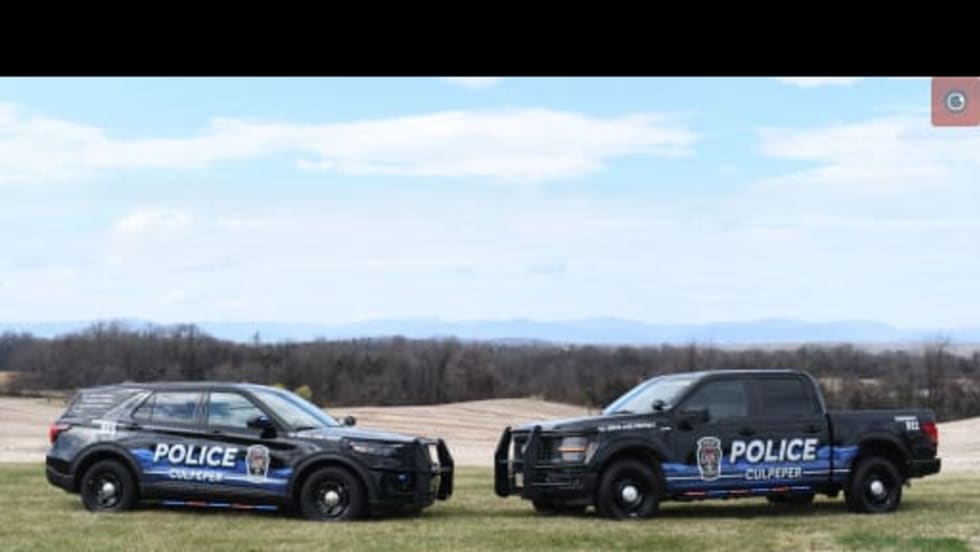
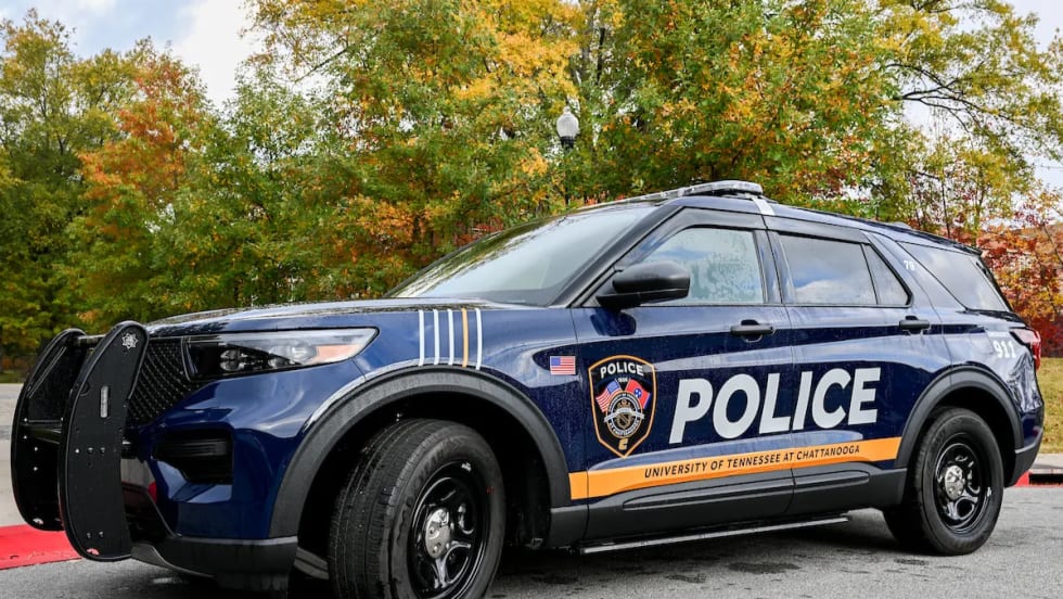
The Culpeper Police Department has unveiled a new fleet design inspired by the Blue Ridge Mountains, selected through a department-wide process involving both sworn and civilian staff.
Powell, Ohio, is using fleet data and lifecycle analysis to guide police vehicle purchases and replacement timing, a strategy expected to save the city nearly $400,000 over five years.
Working to eliminate errors and challenges and increase reliability during fueling, the Madison County Sheriff’s Office has implemented RoadFlex for its 37-vehicle patrol fleet.
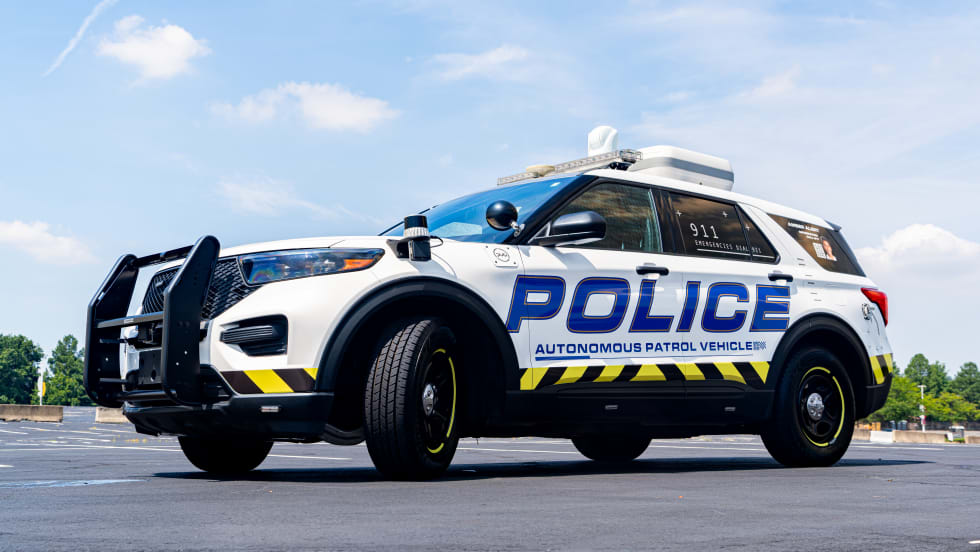
How an uncrewed police ground vehicle is providing technical assistance to the Miami-Dade Sheriff’s Office through a pilot program with the goal of supporting officers and reducing crime through increased marked police presence.
The Police Fleet Innovators Award is for fleet operations teams that have come up with innovative solutions to common problems in law enforcement fleets. Click for deadline details, plus an award FAQ.
What did police fleets actually wrestle with in 2025? We highlight the most impactful stories on vehicles, funding, technology, and operations, distilling the key takeaways for fleet and command staff.
How Mansfield PD addressed weather-related risks to its patrol vehicles, and what fleets need to know about planning and specifying protective structures for similar conditions.